Fort Loudoun State Park in the Tennessee River Valley and Mountains
From Vonroe, at the junction of 411 and TN 360, go southeast on TN 360 for about two miles. Crossing Tellico Lake along a land bridge you arrive on the Great Island. Reaching the island you will come to a sign on the left for Fort Loudoun State Historical Area, the main entrance to the park.
Just pass this sign and on the right is the Sequoyah Birthplace Museum, this historical Cherokee site and museum are fitting neighbors to Fort Loudoun, both sharing the same island. Sequoyah was a significant contributor to the cultural advancement of Cherokee by structuring a writing system that would further unite his people in their ever-challenging relations with the new government. The museum has many exhibits and artifacts depicting the lives of the Overhill Cherokee.
 Turning into the Fort Loudoun State Historic Area you enter a 1200-acre island parkland with trails, picnic areas and lake front access for swimming, floating or canoeing. The approach road leads a mile or so to the parking area. This section of the road is set in a natural wildlife surrounding offering a sense of what the landscape might have been like in the late 1750’s. Turning into the Fort Loudoun State Historic Area you enter a 1200-acre island parkland with trails, picnic areas and lake front access for swimming, floating or canoeing. The approach road leads a mile or so to the parking area. This section of the road is set in a natural wildlife surrounding offering a sense of what the landscape might have been like in the late 1750’s.
Reaching the parking area Mrs. Highlander and I left our horseless carriage behind and made our way to the Fort Loudoun Visitor Center and Museum. The center houses a book and gift shop, informative displays of artifacts unearthed from the site along with early photos of the fort’s ruins, some period weaponry, and a theater room offering an entertaining and educational film presentation. Past the visitor’s center is a paved trail leading up to the fort along the narrowing end of the island forming a peninsula. Along this trail to the fort is where time begins to changes.
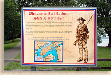
Fort Loudoun was the only planned British fort in the "Overhill" country during the French and Indian War. The fort helped ally the powerful Cherokee Nation to the English cause and block further French penetration of the area from the west.
Named after John Campbell, the fourth Earl of Loudoun, Fort Loudoun had its inception from Governor James Glen of South carolina who saw the need for a fort among the Cherokee as early as 1746. However, actual construction of the fort did not begin until 1756.
Tragedy was to befall the fort in less than two years later. A breakdown in relations between the British and the Cherokee contributed to the surrender of Fort Loudoun and brought violence to the southern frontier by 1760.
Facilities at Fort Loudoun State Park
Visitor Center
Museum
Reconstructed Fort
Stabilized Ruins of the Tellico Block House
Boat Dock
Picnic Areas
Activities at Fort Loudoun State Park
Picnicking
Fishing
Swimming
Hiking
Historical Interpretation and Demonstrations
Scheduled Guided Tours
Scheduled Re-enactments
Park Hours: 8:00 a.m. until sunset
Directions from Knoxville: I-75 South to Hwy. 72 East (Loudoun Exit). Drive 20 miles on 72 South to Hwy. 411. Turn on 411 North until it intersects Hwy. 360 South. Turn Right onto 360 South in Vonore, TN. The park is located one mile further on the left.
for more information:
Fort Loudoun State Park
338 Fort Loudoun Road
Vonore, Tennessee
423-884-6217
|