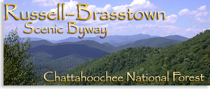
Russell - Brasstown Scenic Byway
Chattahoochee National Forest
For the tablet mobile version of this drive along with a GPS Map, click here.
For the phone version of this drive along with a GPS Map, click here
Russell-Brasstown Scenic Byway is best described as going to the rooftop of North Georgia Mountains. This 38-mile trek ascends the very heights of the Georgia’s mountain country and brings you into contact with some of the most spectacular natural wonders the North Georgia Mountains have to offer.
To experience this treasured scenic driving tour go north from Helen in White County, Georgia on highway 17-75 approximately 2 and a half miles and make a left onto alternate highway 17 may also be marked GA 356. You know you made the right turn if you crossed the bridge over the Chattahoochee River just pass the flea market and tubing company. A short drive thru the foothills of White County will bring you to GA 348, a forestry sign reading Russell-Brasstown Scenic By-Way will indicate a right turn onto GA 348 here is where your journey begins.
You now enter the Chattahoochee National Forest and begin your ascent. Watch for Dukes Creeks Falls sign on the left side of the road, Here you’ll find a parking area, at the end of the parking area is an overlook view of the Georgia lowlands along with the sight of Yonah Mountain setting solely on the horizon. If you take the path along one side of the parking area you’ll come to the observation deck overlooking Dukes Creek falls below, if you continue on the trail it will take you down below the falls for a closer view the climb back up is strenuous. In a more in-depth story the Highlander will explore a shorter route to the top of the falls, that will be included in our virtual tour of Russell-Brasstown Scenic By-Way.
Leaving the Dukes Creek Falls parking area you continue the scenic drive, after a very short distance you’ll arrive at Raven Cliffs Falls Trail in Raven Cliffs Wilderness. Turn left following the road to the parking lot. The trail to Raven Cliffs follows along Dodd’s Creek passing several modest waterfalls before reaching Raven Cliff Falls. Here you reach the trails namesake when you encounter the massive rock cliffs rising vertically from the floor below with Raven Cliff Falls (Dodd’s Creek) pouring through a crevasse and down the cliffs, this is a very popular trail located on the very edge of the Blue Ridge Mountains.
Back on GA 348 you continue driving upward winding thru the Chattahoochee National Forest. Along the road you’ll encounter several overlooks, the higher go the larger the vista. Just before reaching the roads summit an overlook on the left looks down onto North Georgia’s Dahlonega Gold Belt. A full view of Yonah Mountain is seen from here with the mountains large cliff face dominating the view; this mountain is very popular with rock climbers and repelling. The Georgia Piedmont stretches across the horizon as far as the eyes can see.
Leaving the overlook you climb the curve to Hogpen Gap and cross the Appalachian Trail. If you have time you can always stop and take a break here and take a short hike on the trail just so you can tell your friends you hike a piece of the 2,100-mile Appalachian Trail even if you only walk for 15 minutes. Just past the Appalachian Trail parking lot is an overlook of the interior of the Blue Ridge Mountains. The view from here is spectacular, the accompanying picture above is such a view, and the highest point in the distance is Brasstown Bald and the finale point of this journey.
The descent down the mountain is steep, you might want to put the transmission into a lower gear, refer to Driving Tips. You’ll glide down the mountain slope for several miles before reaching the foot of the mountain, slow down and put your transmission shift back into drive, form here you continue along narrow pasture-lands until GA 348 ends. Take a right on GA 180 and continue east for several miles, a long ascent will take you to the entrance of Brass town Bald on the left.
After entering the park a steep paved winding road will lead you to the upper parking area just below the bald. Along the way you’ll witness beautiful mountain scenery. One of the Highlanders favorite times to visit Brasstown Bald is when the Rhododendron are in bloom in late spring and early summer, fall is always a great time to visit. Next to the parking area is a gift shop and a trailhead to the top of the bald. The trail is paved but steep about a half a mile up, I’ve hiked the trail up before but prefer to pay a modest fee for the tour bus ride up, the prepaid ride will take you back down also, if your not in a hurry you can take on the trail back down it’s more enjoyable that way a walking stick will relieve some of the pressure off your knees along the descent.
At the very top of Brasstown Bald is a huge circular stone and wood observation deck with a stone tower large enough to be seen from the valleys below. The tower always been closed when I’ve visited each time likely needs renovation the tower very old. There’s a sizable museum along side the observation deck with some very nice displays and an interpretive film about the evolution of Brasstown Bald and surrounding mountains visitors should make time to see these events.
The views from the top of Brasstown Bald are stupendous; from here you can view all of the North Georgia Mountains and parts of southwestern North Carolina. To the west is the great valley of the southern most Blue Ridge Mountains with Blood Mountain and Duncan Ridge running along the southern part of the valley and the Rich Mountains and the mountains of the Cohutta Wilderness forming the western border of the valley. To the east is the Enchanted Valley and the crystal blue waters of Lake Chatuge and the town of Hiawassee in Towns County. Just below Brasstown Bald to the northwest is Track Rock Gap, prehistoric site of the ancient petroglyph, stone carving dating back 10,000 years. There’s a trail from the top of Brasstown Bald to Track Rock Gap but it’s a long trail and what goes down must come back up. You can reach this extraordinary site by a paved road just off of highway 76 east of Blairsville; you can obtain a map to the site at the local Blairsville welcome center on highway 515.
Brasstown Bald is considered the highest point in North Georgia at 4,784 feet, the massive mountain range of Brasstown Bald divides the counties of Union and Towns and sets dead center of the North Georgia Mountains. Yet some consider Rabun Bald in Rabun County North Georgia, standing at 4,696 is a statistics error. The hike to the top of Brasstown Bald is half a mile where as the hike to the top of Rabun Bald’s from the parking lot is 2 miles. Fans of Rabun Bald claim the view from the observation tower is better. You can visit both and see for yourself yet Brasstown Bald does have that fancy mountain history museum and I don’t want to squabble over a few feet plus they do offer that tour bus ride to the top.
Russell-Brasstown Scenic By-Way is a breath taking experience. This 38-mile day trip that will leave you spell bound and hungry for more.
the Highlander
Want to know more about Helen or Cleveland , Blairsville or Suches, Young Harris or Hiawassee
Although very enjoyable, the mountains can be a driving challenge to a flatlander (no offense), to help you with your new venture, take a look at our driving tips.
|