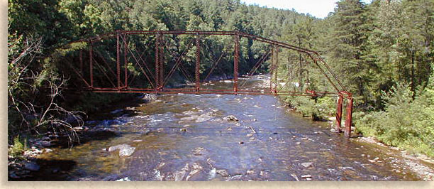
Chattooga Wild and Scenic River
Finding its birthplace on the watershed of the Eastern Continental Divide in the Nantahala National Forest in Jackson County North Carolina is the Chattooga River. The Chattooga River begins its journey in the southern most reaches of Jackson County traveling a short distance before crossing the state line and forming the forty-mile river border that divides the northern edge of two southern states, South Carolina’s Oconee County and Georgia’s Rabun County.
The Chattooga River is considered the crown jewel of wilderness-rivers in both Canada and the United States. Designated by Congress in 1974 as a National Wild and Scenic River, the river has been placed in the “World Class” category of rivers due to its unique geology and high percentage of rainfall.
Due to its order of preservation the Chattooga River allows no motorized vehicles within 1/4 of a mile of its banks keeping the river clean and pristine. The Chattooga River was used as a backdrop for the filming of the book and movie Deliverance. The Chattooga River’s numerous gorges, waterfalls and high cliffs and bluffs often resemble a remote canyon, a mountain waterway Utopia lost in a prehistoric time separated from an outside world and all modern convenience.
The Chattooga River divides two states and two National Forest, the Sumter National Forest in South Carolina and the Chattahoochee National Forest in Georgia. Though secluded the Chattooga River hosts over 100,000 visitors each year who come to enjoy adventure of whitewater rafting, kayaking, canoeing, tubing, hiking, some swimming mostly wading, fishing and some great fly fishing challenges. A natural corridor carved by the hand of time cutting a deep path thru the outer edge of the Blue Ridge Mountains.
Dropping from its headwaters at 3,000 feet to its lowest point of 950 feet at Lake Tugalo, the Chattooga River creates a rapid water flow that adds to the rivers legendary fame for thrills as a wild whitewater river. From Lake Tugalo the waters of the Chattooga River joins forces with the Tugalo River heading southeast hooking up with the Savannah River as it makes its journey to the Atlantic Coast.
Chattooga River
Section 2
Highway 28 Put in to Earl’s Ford
Class 2 • 7 Miles
Minimum Suggested Level: 1 Feet (bare minimum) • Maximum Suggested Level: 5 Feet
The Gauge for this river is located at Highway 76, miles downstream
The Chattooga River is relatively calm for about 7 miles. Shelf-like rapids and only one Class 3 rapid (Big Shoals) make this portion of the river an excellent area for novice whitewater boaters.
The major put-in point: State Highway 28 where a 30-yard portage is required. Most boaters take out at Earl's Ford and carry their equipment 1/4-mile ( 420 meters) to reach vehicles. Average floating times for Section II are based on the gauge on the west end of the State Highway 28 Bridge
Section 3
Earl’s Ford to Route 76 Bridge
Class 2-4(5) • 13 miles
Minimum Suggested Level: 1.2 ft (bare minimum)
Maximum Suggested Level: 3 ft (Experienced paddles can go at higher levels with caution.)
At Earl's Ford, the River again gathers momentum as it plunges over ledges, around boulders, and through steep gorges. This section requires expertise. Scouting of rapids is necessary. Numerous fatalities have occurred along this segment of the River. To enter this 14-mile section at Earl's Ford requires a 1/4-mile walk in.
A good test of boating ability is at Warwoman Rapid (the second rapid), located about 1/4-mile (400 meters) below Earl's Ford. This rapid requires an S-shaped maneuver near the left bank. If you have problems here, turn back, as much more difficult rapids lie ahead.
At the Narrows, vertical rock walls constrict the River to a dangerous 15-foot wide channel which is nearly impossible to portage. Bull Sluice, a Class 5 rapid, is encountered in a blind curve about 400 yards (370 meters) before the U. S. 76 Bridge. Scouting Bull Sluice is mandatory; portaging is recommended for all but expert boaters. Persons familiar with the River can recognize it by the large exposed rock dome on the Georgia side.
Average floating times for Section III are:
U. S. Hwy. 76 Bridge Gauge
Raft 8 hours
Canoe 7 hours
Kayak 6 hours
Earl's Ford Gauge
Raft 8 hours
Canoe 7 hours
Kayak 6 hours
Rapids
Warwoman Rapid • Class 2+
River Mile 0.3
First Island Rapid • Class 2
River Mile 1.2
Rock Garden • Class 2+
River Mile 1.6
Dick Creek Ledge • Class 3+
River Mile 2.5
Sandy Ford Rapid • Class 3
River Mile 3.0
The Narrows • Class 3+
River Mile 3.5
Second Ledge • Class 3
River Mile 4.0
Eye of the Needle • Class 3
River Mile 5.4+
Fall Creek
River Mile 8.0
Rollercoaster • Class 3
River Mile 9.0
Painted Rock • Class 3+
River Mile 9.2
Thrifts Ferry • Class 2+
River Mile 11.0
Bull Sluice • Class 4
River Mile 12.2
Section 4
Route 76 Bridge to Tugaloo Lake Boat Ramp
Class 2-4+ (5) • 5.2 miles
Average Gradient 60 fpm • Maximum Gradient 117 fpm
Minimum Suggested Level 0.9 feet
Maximum Suggested Level 2.2 feet (Experienced paddles can go at higher levels with caution, especially Five Falls.)
Caution: Crack in the Rock Rapid has many undercut boulders. If something is to happen get rid of your gear and get to the right bank as quickly as possible.
Put in: The put in for this river is where US 76 crosses the river about 8 miles east of Clayton Georgia near Long Creek South Carolina on the Georgia – South Carolina State Line. There is parking on both sides of the river. The Georgia side has enough room for 5 cars and has a $2.00 fee. A short walk to the put in, however you will miss Bull Sluice Rapid. On the South Carolina side you will find a much larger USFS parking lot with no current parking fee. Walk along the paved path about 250 yards to the beach below Bull Sluice or take the trail to the right and put in above Bull Sluice.
Take Out: From the Put in go East (Left) 2.5 miles and turn Right on Orchard Road. Follow Orchard Road until it dead ends on Battle Creek Road. Turn Right, when you come to a sharp right turn in the road, stay on the paved road (you will now be on Damascus Church Road). Bear to the Right onto Bull Sluice Road (you will see a sign for Tugaloo Boat Ramp). The take out will be at the end of this road at the boat ramp.
Rapids
Bull Sluice • Class 4+
River Mile 0.0
Surf Rapid • Class 3
River Mile 0.2
Screaming Left Turn • Class 3
River Mile 0.3
Rock Jumble • Class 3
River Mile 0.9
Woodall Shoals
River Mile 2.0
The Play Spot Above 7 Foot • Class 3+
River Mile 2.2
7 Foot Falls • Class 4
River Mile 2.2
Beaver Skull • Class 2+
River Mile 2.8
Stekoa Creek Rapid • Class 3+
River Mile 3.0
Long Creek Falls Rapid and Playspot • Class 3
River Mile 3.5
Deliverance Rock • Class 3+
River Mile 3.6
Turtle Head Rock • Class 2+
River Mile 3.8
Ravens Chute • Class 3+
River Mile 4.0
Tunnel of Love • Class 2+
River Mile 4.1
The Rapid after Ravens Chute • Class 3
River Mile 4.2
Little Woodall • Class 3+
River Mile 4.5
Camp Creek
River Mile 5.0
Five Falls
(Entrance, Corkscrew, Crack in the Rock, Jawbone, and Sock-em-Dog)
Entrance • Class 4
River Mile 5.1
Corkscrew • Class 4+
River Mile 5.1
Crack in the Rock • Class 4
River Mile 5.1
Jawbone • Class 4+
River Mile 5.1
Sock-em-Dog • Class 4+
River Mile 5.1
Shoulderbone • Class 4
River Mile 5.2
Quaalude • Class 3
River Mile 5.6
Lake Tugaloo
River Mile 6.0
Surrounding Area: The river is also known for its excellent trout fishing opportunities. One can also hike along the river on the Chattooga Trail. Horseback riding is allowed on the nearby Rocky Gap/Willis Knob Horse Trail. Because of the vast area covered by the Chattooga River, a number of different attractions are easily accessible. In South Carolina, the small apple orchard communities of Long Creek and Mountain Rest are nearby. In Georgia, Clayton is only 15 minutes away, while a little farther away are beautiful attractions on the Chattahoochee National Forest in Georgia and the Pisgah and Nantahala National Forests in North Carolina.
Directions: Many put-ins exist, some of which are accessible by automobile. However, due to the Wild and Scenic corridor, most of the river is accessible by a .25 mile or more hike. Water-proof maps are sold at the Ranger Station.
Requirements: All boaters must self-register at put-in information boards. Special-use permits are required for commercial uses. Detailed rules and regulations are posted on information boards.
Difficulty Level: Varies according to water level, activity, and location on the river. Whitewater conditions require moderate to expert experience.
Safety: Whitewater is extremely hazardous. Always practice water safety. Leave your itinerary with someone you know.
Many people lack the equipment or skill needed to run the Chattooga River safely. Three companies are commercially licensed to operate on the Chattooga by the USDA Forest Service. These companies also provide instructional clinics in whitewater canoeing and kayaking.
Individuals interested in floating the river on non-commercial trips should contact:
USDA Forest Service
Andrew Pickens Ranger District
112 Andrew Pickens Circle
Mountain Rest, South Carolina 29664
Telephone: (864) 638-9568
Fax: (864) 638-2659
Hours: Monday–Friday, 8 a.m.– 12 p.m. & 12:30 p.m. - 4:30 p.m.
Coneross Creek
SC 59 to Coneross Hydro Plant
Class 2-3(4) • 1 mile
Minimum Suggested Level: 60 cfs
Rapids
Dam Drop (below the dam) • Class 2
River Mile 0.0
Boof Ledge • Class 3
River Mile 0.1
The Final Slide • Class 3
River Mile 0.3
The Run from Below
River Mile 1.0
Chauga Scenic River
Sections of the Chauga River are popular for whitewater kayaking. The most adventurous section starts at Cassidy Bridge with is a 9.8 miles (15.8 km) section that is rated up to Class IV at high water.
The Chauga River's source is the confluence of Village Creek and East Village Creek about 1 mile (1.6 km) south of Mountain Rest, South Carolina in the Andrew Pickens Ranger District of the Sumter National Forest. A little over 1 mile (1.6 km) downstream, it is joined by Jerry Creek, which flows from Lake Becky and the Oconee State Park. Then it crosses Cassidy Bridge at the Cassidy Bridge Primitive Camp. Then it is joined by Cedar Creek and Rocky Fork Creek. After it crosses US Highway 76, it is joined by Ramsey Creek at Chau Ram County Park. There it goes over a waterfall at the park and is crossed by a pedestrian suspension bridge. Then it flows south to Lake Hartwell that was formed by damming the Tugaloo River and the Seneca River.
Section 1
Verner Mill Road to Blackwell Bridge
Class 2-3(5) • 3 Miles
The Chauga Gauge need to be at 6 inches or more
Section 2
Route 193 to Route 290-Cassidy Bridge (Chauga Narrows)
Class 2-3(4) • 5.4 Miles
The Gauge is located on the river right on Cassidy Bridge pilling. -3 is a good minimum.
All class 2-3 with a 100 yard class 5 about .5 miles into it.
Section 3
Route 290/Cassidy Bridge Road to Cobbs Bridge Road. (Chauga Gorge)
Class 4 • 9.8 Miles
Average Gradient 40 fpm • Maximum Gradient 150 fpm
Rapids
First Slide • Class 4
River Mile 0.7
First Slide – Right Lane • Class 4
River Mile 0.7
Super Sock Em Dog • Class 4
River Mile 1.2
Second Gorge Slide • Class 3
River Mile 2.9
Blackhole • Class 3+
River Mile 3.0
Edge of the World • Class 4+
River Mile 3.9
Riley Moore Falls • Class 4+
River Mile 8.0
Section 4
Cobbs Bridge Road to North Horseshoe Bridge Road (thru Chau Ram Park)
Class 1-2 (3) • 7.5 Miles
Average Gradient 20 fpm • Maximum Gradient 40 fpm
Check the Gauge on the Chattooga to be over 2 feet and Flat Shoal River should be running
Flat Shoal River
Section 1
Highway 11 to Flat Shoals Bridge
Class 1-3 (4) • 4.5 Miles
Average Gradient 60 fpm • Maximum Gradient 200 fpm
Minimum Suggested Level 1.8 ft
Rapids
Highway 11 Hole • Class 2
River Mile 0.0
Flat Shoal Falls • Class 4
River Mile 0.1
First Ledge • Class 4
River Mile 0.1
Second Ledge • Class 3+
River Mile 0.1
Third Ledge • Class 3
River Mile 0.2
Last Ledge • Class 3
River Mile 0.2
Surprise Ledge • Class 3+
River Mile 0.7
Little River Lane
River Mile 2.5
Mystery Slide
River Mile 3.5 • Class 2+
Final Slide • Class 2+
River Mile 4.5
Section 2
Flat Shoals Bridge to Tanyard Bridge (SSR 37-24)
Class 1-3 • 3 miles
Average Gradient 20 fpm
Minimum Suggested Level: 1.8 ft
Rapids
Flat Shoals Bridge Rapid • Class 2
River Mile 0.0
Flat Shoals Bridge Rapid from Downstream • Class 2
River Mile 0.0
Blind Slide • Class 3
River Mile 0.5
Blind Slide More • Class 2+
River Mile 0.5
Final Slides • Class 3
River Mile 3.0
Tanyard Bridge Slide • Class 3
River Mile 3.0
Little North Fork
Highway 11 to Tanyard (SSR 37-24)
Class 1-3 • 8 Miles
Minimum Suggested Level 2.5 ft • Maximum Suggested Level 10 ft
To gauge this water check the rapid at the take out
Snow Creek
Snow Creek Road to Lake Hartwell
Class 1-3 • 2.5 miles
Average Gradient 60 fpm • Maximum Gradient 80 fpm
Minimum Suggested Level: 600 cfs
This water takes a lot of rain and needs to be currently raining.
Back
to South Carolina's Rivers and Creeks |