![]()
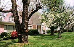
Blue Ridge, Georgia....."The chief claim this town has upon the balance of mankind is its record of health. Purer water and air never existed. Situated 2,000 feet above the level of the sea, its water gushes out of subterranean caverns in pristine purity"...Ellijay Courier, 1887.
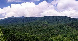
This story begins hundreds of miles to the north, at the very upper tip of the Blue Ridge Province. A solitary mound of earth rises from the ground to a modest height, its own roots, are bound deep into the earth, reaching back in time to the days of the first turns on the Great Potter's wheel.
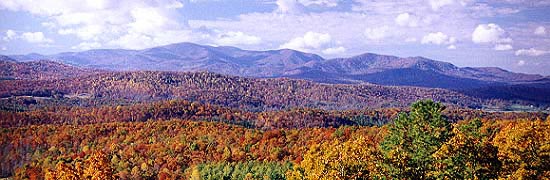
The shape begins to repeat itself in a straight line heading southwest, slowly climbing in height, as each new hump rises higher than the last. It's as though the first mound hides the end of a long tail that anchors the expanding mountain range. Once the mountains enter southwestern Virginia, the ranges are splitting off, doubling and tripling. By the time the mountains reach the states of North Carolina and Tennessee these mountains expand in width and height forming what is known as the roof top of the eastern United States. Mount Mitchell, being the tallest at 6,684 ft. while the Great Smoky Mountain's Clingman's Dome, checks in at 6,643 ft. Small by western United States mountain standard, yet so old and warn with age that they make the western mountains appear as over grown grandchildren.
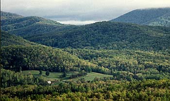
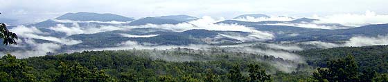
These ancient mountains continue to press on southeast, expanding into dozens of ranges, scattered densely from east to west. From a small mound in the north, to a mammoth width in the south, it has the appearance of a lava flow that has engulfed the entire western section of North Carolina. This flow spills over the full length of Tennessee's eastern border, and pouring south, into North Georgia some twenty five to thirty miles, bringing the Blue Ridge Mountain's southern wall to a final end.
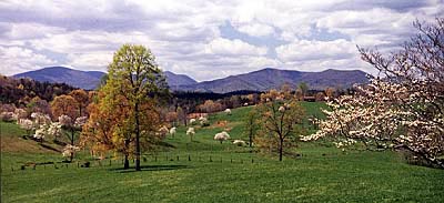
This region is the furthest southern reaches of the Blue Ridge Province and popularly known as the North Georgia Mountains.
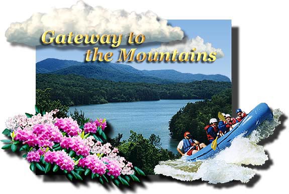
Approximately one hour north of Atlanta on interstate 575/515, you approach an opening in the Blue Ridge Mountain wall. This outer doorway opens onto a corridor that travels a gentle upgrade for 16 miles. This corridor divides two wilderness/wildlife management areas, the Cohutta and the Rich Mountain Wilderness areas. Once you reach the interior doorway, you'll find you're on the edge of an enormous valley, completely surrounded by high mountain peaks. This valley extends approximately 25 miles across, point to point crossing, with several small mountain ranges, rivers and a continuous flow of rolling hills. It's from this advantage point, as you enter the valley that the inner corridor gets its name..."Gateway to the Mountains."
Welcome to Fannin County, the southwest corner of what the Highlander calls, "the big valley." Here you'll find a wealth of forests, mountain trails, a crystal blue lake, fresh air and friendly folks. Fannin County is a great place to visit with a rich history that varies from hardships, to inspired grandeur.
The Cherokee
North Georgia, Eastern Tennessee and Western North Carolina, was home to the Cherokee Nation. The Cherokee people were known as the civilized tribe. They built and lived in log homes, and many became Christians with the more prosperous individuals, being slave owners.
Sequoyah, (native Cherokee) founded a system of writing in 1821. It was meant to help the Cherokee people in their dealings with the white government. The Cherokee referred to the treaties as "talking leaves." So adapted were the Cherokee to the newly formed U.S. government, (only 47 years old at the time) that in 1823, the Cherokee adopted parts of the U.S. Constitution into their own Cherokee Nation Constitution. They were slowly evolving into U.S. citizens under specific territorial agreements.
Being completely enclosed by high ranges, the Cherokee of the southern Blue Ridge Mountains lived a life of remote pleasure, hunting, fishing, farming and trading with the white settlers. The Cherokee also enjoyed warring with other local tribes over territory. Games were often used to settle disputes, with harsh consequences to the losers.
The first encounter the Cherokees had with European explorers came in 1540. DeSoto and the Spanish Conquistadors were searching for the "legendary gold." Starting in Florida, the Conquistadors traveled north through Georgia and on into parts of Western North Carolina. It took nearly three hundred years for the legacy of DeSoto to manifest like a fire storm.
DeSoto came up short of any significant discovery of gold. The influence of these explorers and those to come, played a strong role in the local Native American lifestyle. Tools, weapons, supplies and some of the white man's ways offered benefit to the tribes. The downside...disease, whisky and several hundred years of genocide.
The continuation of self government were the major concerns of the Cherokee people. From 1721 to 1828, the Cherokee signed 37 treaties, losing more land and rights with each new treaty.
Originally the mountains had little to no appeal to white settlers. The mountain terrain was too steep, difficult to farm, and had poor access, "so let the 'Indians' have it." That all changed in a heart beat. Gold was discovered in North Georgia in 1828, and gold fever captivated the mind of fortune seekers.
In 1832 the U.S. government allowed the Cherokee land to be divided by lottery. The land was separated into gold lots of 40 acres, and land lots of 160 acres. More prospectors than allotted began to force their way into the treaty lands.
The Cherokee continuously protested, and on May 23,1836, "The Treaty of New Echota" was signed by President Andrew Jackson. This treaty forced the removal of the Native Americans from Blue Ridge Mountains and outlying areas to lands west of the Mississippi River. This forced evacuation peaked in 1838 and is known as the "Trail of Tears." This journey of hardships, took the lives of thousands of the Cherokee people before they reached the new treaty lands in Oklahoma..
A small number of the native inhabitants chose to hideout in the high country, eventually trading and working with the new arrivals, posing no threat or rightful claim to land they were allowed to remain. Thanks to those that stayed behind, the Blue Ridge Mountains are still enriched with Native American history and customs.
New Mountain Culture
After the evacuation, a new mountain culture started to develop, land was being farmed, new towns and governments were established. The Blue Ridge mountains were changing, but mostly for the worst. Gold fever, copper mining and mass logging started to destroy the ecosystem. (this exploitation of natural goods went on throughout all the eastern U.S. mountains) The hunt for gold in mountain streams, hydro and shaft mining devastated pristine sites. Copper mining stripped a northern section of the valley floor, with the majority of copper mining being done in the area of southeastern Polk County, Tennessee.
Loggers pursued the rich forest land, leveling the mountain slopes, supplying the demand for lumber goods, to a growing nation. Mother nature was being stripped of the ancient forests and mineral deposits that had been so sacredly preserved for a billion years. These pursuits not only stripped the land, but it also polluted the purity of the waterways.
Many parts of Fannin County managed to maintain its natural dignity during this time. Gold prospecting took the least toll, because it was a difficult process. Also, the "1849 California Gold Rush" took a lot of pressure off the Blue Ridge Mountains.
More recent surveys claim that the southern Blue Ridge Mountains, referred to as the "Gold Belt," still holds the majority of its wealth in gold. The estimate is that 80% of the original gold is still here, making the North Georgia mountains a favorite, for amateur gold hunters.
There is a silver lining in this dark cloud, thanks to the United States Forest Service's Department of Agriculture. In the late 1890's and early 1900's, the USFS purchased large tracts of virgin wilderness and other land that was stripped by loggers. They replanted the forest to be preserved and nurtured for future generation to come. This has been an endless goal for the United States Forest Service and an excellent endeavor at saving this beautiful land for all of us.
Fannin County
 Fannin County was approved as its own entity, by
the State of Georgia in 1854 from parts of Union and Gilmer County.
The town of Morganton was the site for the Fannin County seat. Farm
communities and modest towns were quickly becoming permanent fixtures
within the county.
Fannin County was approved as its own entity, by
the State of Georgia in 1854 from parts of Union and Gilmer County.
The town of Morganton was the site for the Fannin County seat. Farm
communities and modest towns were quickly becoming permanent fixtures
within the county.
Controversy arose
in Fannin County when the railroad proposed to build a rail line through
the mountains. Morganton felt the railroad should naturally go through
the county seat, the railroad didn't feel that Morganton provided the
best route. Although much controversy erupted before the final decision,
the railroad chose another location for the railroad hub. 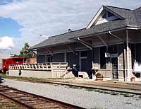 As a result of this
decision, the town of Blue Ridge came into being, and was incorporated
in 1887. Blue Ridge took its name from its location at the southern
gateway of the Blue Ridge Mountains
As a result of this
decision, the town of Blue Ridge came into being, and was incorporated
in 1887. Blue Ridge took its name from its location at the southern
gateway of the Blue Ridge Mountains
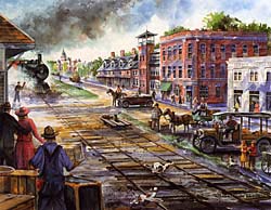
The future had arrived in Fannin County as of 1889, the railroad would carry passengers supplies and modern convenience to this new frontier, while hauling raw materials from the mountains to the low lands.
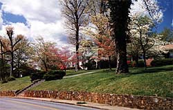
Blue Ridge became a boom town as a result of "the great iron highway." Entrepreneurs, investors and tourists headed to North Georgia in the late 1800's and early 1900's, for much the same reason they do today. Visitors flocked to the mountains, to get away from over crowded cities, and stay in one of the many hotels or summer homes, not just for a weekend but for longer periods of recuperation.
Mineral potions were the rage during this era, and Fannin County had pure mineral springs. These springs' boast of rejuvenating powers for all your ailments. Many people attested to the curative properties of the mineral springs and their own personal healing miracles. Most felt it was a combination of good water, fresh air, wholesome foods and the lack of stress offered by the beautiful landscapes and the laid-back mountain lifestyle. Visitors returned home after each visit with a fresh outlook and they have been returning seasonally for over 100 year.
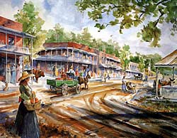
All attention was on Blue Ridge during this time. Hotels and inns sprang up along both sides of the tracks as well as restaurants, dry goods stores and stables. A railroad hub-machine shop was built in Blue Ridge, employing a large numbers of people from the county. Prominent homes were being built along with schools and churches. This growth required Fannin County to eventually move its county seat to Blue Ridge for convenience sake in 1895.
Over the next dozen years, travelers from Atlanta and Knoxville came to this popular luxury resort and health spa area, by the droves. The demands were so large that the railroad had to add "extra" and "special" passenger trains to an already busy rail line.
An 1887 newspaper article in from the neighboring town of Ellijay, gives us a view of the activity that was present during the birth of Blue Ridge, the railroad and the mineral spas....
"Its hills that jut up in mid air kiss the first rays of the morning sun and are fanned by an undisturbed breeze. Fannin County stands at the head of the list of American counties for health, the mortality being only five percent. As a health resort, it stands without superior and those who are disposed to invest capital that way are not slow to perceive its splendid inducements.
There are also a number of mineral springs in the town that deserve more than a passing notice. Lots are being sold almost every day, and on last Tuesday seventeen lots were sold, and as captain Frank Walton remarked, "It wasn't much of a day for selling lots, either." People from all over the state and many without are investing in Blue Ridge dirt, if for no other purpose than to await future development. More could be said in this article, but we wait for another issue.
With a $700 church, a $1,000 Academy, a $40,000 hotel, and other attendant improvements, we see no reason why Blue Ridge, with all her mineral wealth and her health given chalybeate water, may not yet bloom out the pushing town of North Georgia Messers. McKinney and Walton, who own the real estate, intend to make a town of that place whether fate so decrees or not."......The Ellijay Courier, 1887.
In memory of Richard Low Evans 1915 to 1998
Visions for a great mountain city were born out of raw forest, mineral springs, iron rails and a lot of capital investments. Blue Ridge was preparing a great stage for the "gilded age," high society, social fare, good health and daring investments. During this era the town of Blue Ridge grew, not by humble abodes, by homes of substantial means. Visionaries and idealist thought they were on their way to building a new Utopia.
 Up
the rail line from Blue Ridge was Mineral Bluff, another Fannin
community, known for its inspirational water and spa retreats. Mineral
Bluff pre-dates the railroad and grew quickly to accommodate the accelerated
growth. Over time, Mineral Bluff drifted quietly back into the tranquil
little community that it is today.
Up
the rail line from Blue Ridge was Mineral Bluff, another Fannin
community, known for its inspirational water and spa retreats. Mineral
Bluff pre-dates the railroad and grew quickly to accommodate the accelerated
growth. Over time, Mineral Bluff drifted quietly back into the tranquil
little community that it is today.
In 1906, the railroad's machine shops were moved further up the line into Tennessee, the progressive momentum of Fannin County was beginning to slack. The hordes of mineral mining was running thin. By the 1920's, 80% of the ancient forest was lost to loggers, land clearing or disease. Copper mining defoliated 60,000 acres before its halt, some of which were in northern Fannin County, although the majority of the copper mining was done in the southeastern corner of Tennessee.
The demand for raw materials seemed inexhaustible, the land yielded its bounty, and had no defense. Vast land tracts were barren and in need of replenishing, nurturing and preservation, a great atrocity had been committed. In the end, the users and takers had to turn their less than conscientious pursuit into a conscience awakening.
The County and Forestry
 President Theodore Roosevelt and other concerned citizens
inspired a nationwide conservation movement in the 1890's. Congress
passed legislation for preserving public wilderness. In 1905 these lands
were entrusted to the Forest Service of the U.S. Department of Agriculture,
also known as the United States Forest Service.
President Theodore Roosevelt and other concerned citizens
inspired a nationwide conservation movement in the 1890's. Congress
passed legislation for preserving public wilderness. In 1905 these lands
were entrusted to the Forest Service of the U.S. Department of Agriculture,
also known as the United States Forest Service.
Today, the wilderness of Fannin County is in the hands of conservation
groups and the USFS. Under their protection and management this region
of the Blue Ridge Mountains has returned to its former lush state, minus
most of the old forest and some mineral deposits.
Traces of the old forest can still be found, at higher altitudes and hard to access regions. Regional mining operation have been turned into a museum site and some trails to old mines are maintained for hikers, like the. "Old Copper Trail." What was once lost, has returned, this time with a guarantee of protection.
The Blue Ridge Mountains of North Georgia, is the home of the Chattahoochee National Forest. This vast, hardwood forest is divided into several forest ranger districts which controls the mountain lion's share of the land in the North Georgia mountains.
Fannin County is a modest county, consisting of 401 square miles. Within this, 106,103.95 total acres is National Forest. The second highest amount of protected forest land amongst the North Georgia counties. The Toccoa Ranger District in Blue Ridge, oversees the security and management of this particular region.
The western wall of Fannin County is made up of two mountain wilderness areas. The Cohutta Wilderness Area and the Rich Mountain Wilderness Area. The Cohutta Wilderness is the third largest Wilderness in the eastern United States, with 40,006.58 acres of the Cohutta Wilderness lying within Fannin County.
These two wilderness areas are a great attraction and well geared to the serious and experienced backpackers, whereas the National Forest areas are more inviting to the general camper and outdoor enthusiast. The southern reaches of Fannin county is made up of steep, dense mountainous terrain within the Chattahoochee National Forest. The head waters of the Toccoa River have their birthplace here, amongst other natural springs, streams and creeks. The Toccoa River grows in size as it makes its way down, through the remote upper reaches of southern Fannin County.
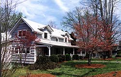
 In the
southern high mountain valley of Fannin Country, along the subtle banks
of the Toccoa River, is a mountain farm community named Dial, Georgia.
Founded in 1834, Dial was one of the first communities settled in this
region. The charm of this community, is that there's no town. Small
farms and a hand full of modest homes dot the fields and river banks.
There are also landmark constructions of barns, out buildings, a large
double decked porch farm house and quaint Victorian farm house to mention
a few. This community hasn't' seen a change in over 100 years, lets
hope it never does.
In the
southern high mountain valley of Fannin Country, along the subtle banks
of the Toccoa River, is a mountain farm community named Dial, Georgia.
Founded in 1834, Dial was one of the first communities settled in this
region. The charm of this community, is that there's no town. Small
farms and a hand full of modest homes dot the fields and river banks.
There are also landmark constructions of barns, out buildings, a large
double decked porch farm house and quaint Victorian farm house to mention
a few. This community hasn't' seen a change in over 100 years, lets
hope it never does.
The Toccoa River
continues to winds on down through the mountains, catching a little
speed here and there. The river takes some hard bends before it reaches
the sizable boulders that laden the river in various places, 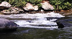 kicking up white water where it pleases, until it reaches
the gentle shores of Lake Blue Ridge.
kicking up white water where it pleases, until it reaches
the gentle shores of Lake Blue Ridge.
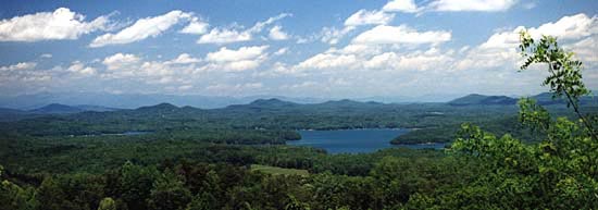
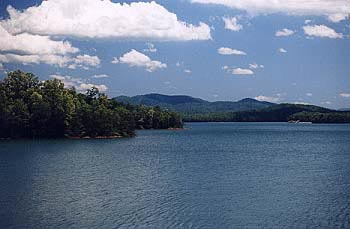
Lake Blue Ridge is a sculpted marvel of earth and water, dug out of the ground by machines and back breaking labor, all conceived through the ingenuity of brilliant engineers. An earthly mirror of crystal blue waters reflecting the blue sky, full white clouds and the worn rigged peaks of surrounding mountains.
Tennessee Valley
Authority
 The Toccoa
Power Company, a subsidiary of the Tennessee Electric Power Company
constructed the lake and dam over a five year period starting in 1925.
The TVA bought the dam and generating plant on August 15, 1939. At this
time the TVA acquired 7,076 acres of land around the lake and transferred
4,073 acres to the U.S. Forestry Service.
The Toccoa
Power Company, a subsidiary of the Tennessee Electric Power Company
constructed the lake and dam over a five year period starting in 1925.
The TVA bought the dam and generating plant on August 15, 1939. At this
time the TVA acquired 7,076 acres of land around the lake and transferred
4,073 acres to the U.S. Forestry Service.
The purpose in building the lakes and dams, were to control the serious problem of mountain floods. Controlling the water flow not only offered a safe alternative, creating hydro dams could generate the much needed demand for electricity. Safety and modern convenience were the original purpose for creating the lakes. Later, the recreational benefits of a mountain lakes would draw the attention of a commerce that had all but disappeared, "vacationers."
Boating, fishing and other watersports bring a steady flow of seasonal visitors to the over 100 miles of Lake Blue Ridge shoreline. Summer homes, as well as year-round residences occupy some of the Lake Blue Ridge shores.
The TVA controls a vast network of watersheds, waterways, lakes and dams throughout the southwestern regions of the Blue Ridge Province. This network travels from Lake Fontana on the southern edge of the Great Smoky Mountains, to the southern banks of Lake Chatuge in the North Georgia mountains.
All waterways under TVA's control flow westward to the Tennessee River which reaches across the state of Tennessee where it passes through its final dam in the Tennessee region known as the "Land Between the Lakes," where it then surges into the Ohio and Mississippi Rivers.
After a few days of R & R in Lake Blue Ridge, the waters of the upper Toccoa River work their way through the dam, and out across the length of Fannin County. The water flows northward, twisting and turning along the way. Hip boots, rod and reel, bait of your choice, need I say more. Approximately 10 miles from the dam, the Toccoa River arrives at the farthest northern reaches of Fannin County at the town of McCaysville.
 McCaysville
is a classic river town on the border of Georgia and Tennessee. The
railroad and copper mines put this town on the map. Copperhill Tennessee
is directly adjacent to McCaysville, unifying the two river communities
as border towns or twin cities.
McCaysville
is a classic river town on the border of Georgia and Tennessee. The
railroad and copper mines put this town on the map. Copperhill Tennessee
is directly adjacent to McCaysville, unifying the two river communities
as border towns or twin cities.
The history of these two towns have seen a seesaw of growth, natural disasters, economic wealth and failure. Presently the twin cities are proud of the comeback wave it is now experiencing at the close of this Century.
Just south of McCaysville you'll find Epworth, originally a farm community, mostly residential today with an old country store worth checking out, and post office. Epworth is located on the route between Blue Ridge and McCaysville.
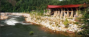
The Ocoee, TVA and the USFS
As the waters of the Toccoa River flow under the bridge that divides Georgia and Tennessee, the river takes on a new identity. The world famous Ocoee River, white water country and the home of the 1996 Summer Olympic's Kayaking Competitions, located in southeastern corner of Tennessee and outside the northwestern outreach of Fannin County.
 The
Ocoee hosts yearly white water event competition as well as its overwhelming
following of white water rafting enthusiast and recreational kayakers.
Due to the opening of the upper Ocoee, you can run the rapids past the
White Water Olympic Center and down the actual Olympic course.
Your going to need to hold on to your oar and stay in the boat, there
are several 5 rated rapids along the upper and middle Ocoee River. The
most powerful rapids in the eastern U.S. for commercial rafting is a
6 rated rapid. The water pressure during the Olympics was more intense
for the competition, the flow being controlled by the TVA.
The
Ocoee hosts yearly white water event competition as well as its overwhelming
following of white water rafting enthusiast and recreational kayakers.
Due to the opening of the upper Ocoee, you can run the rapids past the
White Water Olympic Center and down the actual Olympic course.
Your going to need to hold on to your oar and stay in the boat, there
are several 5 rated rapids along the upper and middle Ocoee River. The
most powerful rapids in the eastern U.S. for commercial rafting is a
6 rated rapid. The water pressure during the Olympics was more intense
for the competition, the flow being controlled by the TVA.
The Ocoee Gorge if a magnificent sight with three dams, two powerhouses and a 100 year old wooden water slough that runs along the gorge's upper walls. The river waters are controlled by the TVA while the gorge, its river banks and the surrounding Cohutta Wilderness, which contains the gorge is controlled and managed by the USFS. The Ocoee River hosts over approximately 300,000 people a year riding the white water. If you would like to read more on white water rafting, check out "Ancient Waters, Thrilling Ride."
United States Forest Services and the Appalachian Trail
 You'll find
well marked trails running throughout the National Forest and Wilderness
areas within Fannin County with numerous campgrounds, and recreational
sites. The local Forestry office, Toccoa Ranger District, located on
Hwy 515 in Blue Ridge can help you with maps, locations and a recreational
directory.
You'll find
well marked trails running throughout the National Forest and Wilderness
areas within Fannin County with numerous campgrounds, and recreational
sites. The local Forestry office, Toccoa Ranger District, located on
Hwy 515 in Blue Ridge can help you with maps, locations and a recreational
directory.
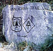 You
can pick up the Appalachian Trail in the southern end of Fannin
County and exit in Maine if you like. The Appalachian Trail travels
the entire backbone and highest reaches of the Appalachian and Blue
Ridge Mountain chain from south to north. Many hikers use the Appalachian
Trail for one day hikes as well, entering the trail at one location
and after the days hike, or even a half day hike, they exit the trail
where they have left a second vehicle for the return trip. If don't
have a second vehicle available, you can hike for a while and then return
taking in the opposite view. Avid hikers find hiking any part, if not
all the Appalachian Trail, a rewarding experience due to trails renowned
reputation. Another trail growing in popularity is the Benton MacKaye
Trail, conceived in 1979. The Benton MacKaye Trail is a 250 mile foot
path, along the western edge of the Blue Ridge Mountains.
You
can pick up the Appalachian Trail in the southern end of Fannin
County and exit in Maine if you like. The Appalachian Trail travels
the entire backbone and highest reaches of the Appalachian and Blue
Ridge Mountain chain from south to north. Many hikers use the Appalachian
Trail for one day hikes as well, entering the trail at one location
and after the days hike, or even a half day hike, they exit the trail
where they have left a second vehicle for the return trip. If don't
have a second vehicle available, you can hike for a while and then return
taking in the opposite view. Avid hikers find hiking any part, if not
all the Appalachian Trail, a rewarding experience due to trails renowned
reputation. Another trail growing in popularity is the Benton MacKaye
Trail, conceived in 1979. The Benton MacKaye Trail is a 250 mile foot
path, along the western edge of the Blue Ridge Mountains.
The beauty you behold today, as you look out across Fannin County, is
due to dedicated conservation. Conservation is vital to the mountains
to preserve and protect our National Forest for generations to come.
The growth of tourism and new arrivals in these mountains is steadily increasing, not just recently but for the last 170 years. The credit and trust of the mountains belongs to the guardians of the forest, the United States Forest Service. They set the standard, it's up to us to follow. Remember to be respectful and responsible when visiting. We are all responsible for our part of preserving the beauty that we have today.
Blue Ridge Georgia is Coming Alive....Again!
The iron rail opened the southern gateway to the Blue Ridge Mountains over 100 years ago with dreams of a super railroad, conquering the remote regions of the mountains. Over a hundred years later it's the super slab, a four lane highway that's conquering the mountain lands today.
Four lanes of traveling ease and scenic beauty pass through the Gateway of the Blue Ridge Mountains into Blue Ridge and the North Georgia Mountains, bringing a new flow of life into a sleepy old railroad town.
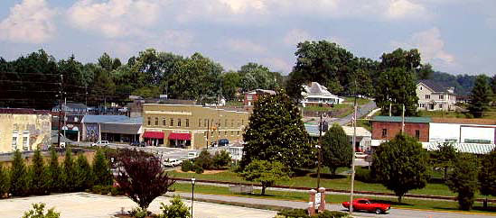
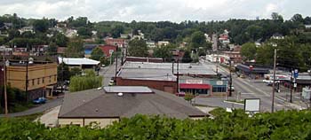
The town of Blue Ridge has seen may changes in its time, and is now on the horizon of a new century of mountain living. The town is growing outward with a community attitude of, "not so quickly, thank you."
To really understand Blue Ridge and what it was, as with many towns of bright eyed ambitions, you'll have to view the fire records, history books, and hear the tales. Old Blue Ridge gives us a view of the great potential it had in the past, and is achieving once again.
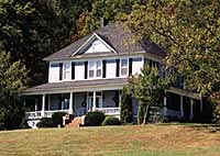
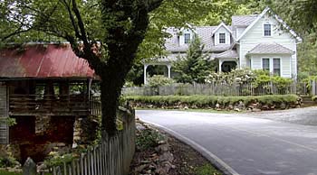
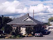
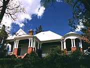
Its always enjoyable to view the old architecture when visiting any town. Within downtown Blue Ridge and surrounding neighborhoods you'll find the remnants of the past. Blue Ridge is a town of historical value, and has several buildings and homes within downtown on the National Register of Historical Places, such as the late 1880's Depot. These structures set the tone for what Blue Ridge once was, and is on its way to becoming again.

Thanks to a group
of dedicated citizens, Blue Ridge was awarded the "Better Home
Town Award" in 1998. Jon Stuart, a local retiree was the driving
force behind the hard work it took to get the award for Blue Ridge.
The "Better Home Town Award" committee had representatives
from the City of Blue Ridge, Fannin Chamber of Commerce, the Blue Ridge
Business and Professional Association and the Blue Ridge Mountain Arts
Association. The award was designed to benefit and increase tourism.
Many improvements were added to downtown Blue Ridge since they received
the award and more plans are in the works.
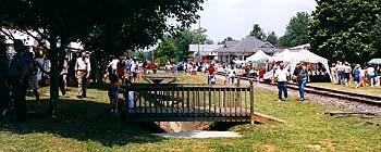
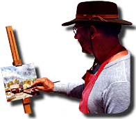
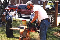
Fannin County has many wonderful artists working in a variety of mediums. The mountain scenery and friendly atmosphere of the North Georgia mountains lends itself to creativity. Blue Ridge is also the home of the Blue Ridge Mountain Arts Association, representing artist throughout the Blue Ridge Mountains. The association hosts an annual "Arts in the Park" festival in the downtown Blue Ridge Park over the Memorial Day weekend. This annual festival draws thousands of visitors. For more information on "Arts in the Park", contact the Blue Ridge Mountain Arts Association at 706-632-2144.

Downtown Blue Ridge is presently an enjoyable collection of specialty shops, antique stores, art galleries, unique gift and furniture shops of all sorts as well as several interesting eateries. Strolling, shopping and dining in Blue Ridge is an enjoyable experience that draws visitors back, time and time again.
Blue Ridge is a prime example of both dignity, and decorum through the transition of a less than forgotten mountain town.
Legends and Myths...Fairy Crosses
Fannin County, like many other regions of the United States, have tales that have been told and rewoven, time and time again. The Native Americans have their tales and spiritual myths to help them understand the great mysteries. Tales of love, adventure, war or cataclysmic occurrence become the tales of all social and ethnic societies. For the most part, these tales are based in some truth, yet it's the purpose and manner of the way the tale is told, that give the stories the necessary impact to survive the test of time.
In the 1830's, when the Cherokee land in Fannin County was given out in lots, it was only offered to residents of Georgia who had been living in the state for three years or longer. By the 1860's it was noticed that Fannin County was being populated by North Carolinians. These were experienced mountain folk, who's families and ancestors worked their way down the Appalachian and Blue Ridge mountains from Pennsylvania. This hardy stock of pioneers were the "Scot's," better known as the "Highlanders."
Natural mountaineers in their homeland, the Highlanders brought with them a special type of experience and European custom. Always feeling the pressure of government in this country as well as the oppression of the British in their Scottish homeland, the Highlanders preferred to hold onto the old ways, while tentatively accepting new ideas. They brought Christianity as their guiding faith while keeping intact many pagan customs and practices of holistic medicines and such. All the while they mingled with the local natives, exchanging ideas, technology, arts, customs and other practices.
Mountain folk practitioners and herbalists had a special place during this era and have become a fascination within the world of modern health. The popularity of the curative mineral springs located in Fannin County blended well with concepts presented by these natural practitioners. Traditions and medical practices hundreds of years old have made up a unique perspective on the mountain culture healing practices....from herbs, to potions, spells, crystals and stones.
When two cultures
such as the Scot's and the Cherokee first collide, then mesh, they begin
to absorb each others customs while maintaining their own particular
traditions. Here you have two different holistic cultures, coming together
not only in commerce but also in faith...Christianity. New myths and
legends can develop out of this newly formed unity of concepts. The
outcome..ancient myth blended with tragedy and new testament theology
meet "staurolite."
Fairy Crosses are probably the most tangible, myth-legend in
Fannin County. They are referred to as crosses, due to their shape.
The mineral name for "fairy crosses" is staurolite. The staurolite
is considered to be the Georgia state mineral. Fannin County stands
as one of the most significant finds of fairy crosses in the Blue Ridge
mountains. Fannin County has also been referred to, by noted mineralogist,
as having the finest specimens of staurolite in the world.
The legend of "fairy crosses" have come down through history from the first meeting of John Smith and Pocahontas, which states that the Indian Princess gave John Smith a good luck charm necklace made of a "fairy cross." It's also known that President Theodore Roosevelt carried an amulet made from a "fairy cross."
Locally there are two popular tales concerning the "staurolite." One states that "staurolite" or "fairy crosses'"are the tears of the Cherokee, who wept over the loss of their homeland during their exodus on the "Trail of Tears." The other tale stems from an older legend concerning an ancient race of mountain fairies. This second tale, tells of the fairies getting together at their favorite meeting place for dancing and gaiety, only to find out during one rendezvous some 2000 years ago, that the Son of the Great Creator died upon a cross. So moved by the loss of one so great in the spirit world, the fairies were crushed in heart and cried. As they wept, their tears fell to the ground and were crystallized into what we know as "fairy crosses." There's another more personal tale about "fairy crosses," that is growing very popular in these mountains, check out the Highlander's "Tears of Fairies" story, told by Nathanael O. Smith, the Highlander's own story teller.
What do we technically know about "fairy crosses?" Well, no two fairy crosses ever found are alike. There are three types. The Maltese Cross is a well formed, perfectly even cross, most difficult to find and highest prized by collectors. The second is the Saint Andrews' Cross, a more common find, with the angled line through the cross instead of a horizontal line. Third is the Prismatic Cross, easiest and more commonly found, a less than perfect shape but crossed just the same. There have also been finds of very rare six point crosses, some of these are displayed in the photo below. From a theoretical point of view, staurolites were created under great pressure and high temperature some 60 to 500 million years ago, either formed from within the earth or arriving on a meteorite. No matter what tale agrees with you the most, staurolite is becoming scarce due to its popularity..."fairy crosses" are as ancient as Fannin County can get.
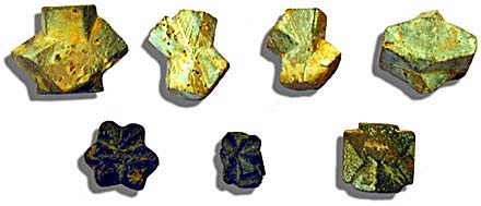
From the collection of Jay at the Rock Shop in Morganton Georgia
Just recently the Highlander got an e-mail from a new fan that found the Highlander while searching for information on "fairy crosses." Gordon is a retired police officer from Florida. He and his wife had dedicated their life to fostering and adopting children that needed homes. This dedication had came about, after years of witnessing abused and neglected children as a result of his job. Gordon and his wife had fostered over 50 children since they began their pursuit and had adopted 10 of children with special needs. He had read an article on "fairy crosses" and thought what a great venture it would be to take his children on a trip to search for their own "fairy crosses" and have them made into amulets to remember them by. Not sure of where to find "fairy crosses," Gordon turned to the internet to find more information on them. In his search, he found Nathanael's (the Highlander's storyteller) "Tears of Fairies." After reading the story, he wrote to us to tell us how much he enjoyed the story, and also told us his own story in hopes we could help him find a good source for their venture. We are happy to say, we brought him to Fannin County.
Fannin County is rich in history and legends as well as rich in the lifestyle it offers visitors today. When planning a trip to the North Georgia mountains, be sure to visit "The Gateway to the mountains....Fannin County"
Paintings by Richard Low Evans, courtesy of the Blue Ridge Arts Association and Mrs. Dot Evans. Prints and note cards are available for sale at the Blue Ridge Arts Association.
![]()
Sign
up for the Blue Ridge Highlander Newsletter, Messages from the Mountains
to find out first about our new feature stories, road trips and special offers
Your e-mail addresses will not be sold or given away to anyone.
Privacy
Policy
Interested in your business being on the Highlander, click here...
Let our visitors tell you about the Highlander...
Click the feathers to go to the Highlander site
map...

Your e-mail addresses will not be sold or given away to anyone.
Let our visitors tell you about the Highlander...
Click the feathers to go to the Highlander site
map...
Highlander Special Interests
Great Mountain Attractions and Destinations Links to All Highlander Advertisers
Blue Ridge Highlander Mountain Emporium Art Gallery Photo Gallery Handmade Products Book Store
Magazine, Virtual Tours and Scenic Road Trips Creative Mountain Classes Just for Kids
Living Green and Eco Friendly in the Mountains Gardening in the Mountains Mountain Recipes
Mountain and Native American History Nathanael O. Smith - Storyteller Mysteries, Myths and Legends in the Mountains
Mountain Cathedral Charities and Fundraisers
Great Mountain Retreats
Adventure • Art • Cooking • Corporate • Family • Friend • Yoga • Wellness • Youth
Learn More About the Towns and Cities in the Mountains
North Georgia Mountains Western North Carolina Mountains
Up Country South Carolina Tennessee River Valley and Mountains
Great Smoky Mountains Blue Ridge Parkway
Move to or Invest in the Mountains
Real Estate • Log Homes • Cabins • Homes • Land • Acreage • Commercial Real Estate
North Georgia Mountain Real Estate Western North Carolina Real Estate
Tennessee River Valley and Smoky Mountain Real Estate
Interior Design and Furniture Shops Schools in the Mountains
Traveling • Living • Enjoying the Mountains
Log Cabin Rentals • Vacation Rentals • Resorts • Condos • Inns • Hotels • Bed and Breakfasts
Luxury Resorts and Spas in the Blue Ridge and Smoky Mountains
North Georgia Mountain Lodging Western North Carolina Lodging Tennessee River Valley Lodging
Plan a Mountain Wedding or Gatherings Conference, Meeting and Retreat Facilities
Vineyards • Wineries • Tasting Rooms Agri-Tourism Farmer's Markets
Yoga Retreats • Spas in the Mountains
Events and Festivals in the Mountains Theatre • Concerts • Mountain Entertainment
Restaurants, Dining and Catering in the Mountains
Shopping in the Mountains Blue Ridge Highlander Mountain Emporium and Art Gallery
Artists, Art Galleries and Art Associations in the Mountains Museums, History and Culture in the Mountains
Family Fun in the Mountains Just for Kids
Adventure and Outdoor Fun in the Mountains
Mountain Adventure Horseback Riding, Stables and Trails Mountain Bike Trails
White Water Rafting and Adventure Zipline • Canopy Tours Fishing in the Mountains
Boating and Marinas Camping and RV Parks ORV Adventures
Scenic Mountain Drives Mountain Golf Courses Mountain Day Use and Picnic Areas
National Parks in the Mountains National Forest Service in the Mountains State Parks in the Mountains
Waterfalls in the Mountains Lakes in the Mountains Rivers, Creeks and Trout Streams in the Mountains
Nature and Wildlife in the Mountains Mountain Birding Hiking Trails in the Mountains
More Information
Home Site Map Advertise on the Highlander Link to the Highlander Contact the Publisher
designed, produced and hosted by